
Opportunities of Geometric Documentation of Historic Buildings with Terrestrial Laser Scanner, Examples from Aksaray/Turkey
DOI:
https://doi.org/10.15320/ICONARP.2018.54Keywords:
Geometric Documentation, Terrestrial Laser Scanner (TLS), Architectural Preservation, Restoration Project, Aksaray TurkeyAbstract
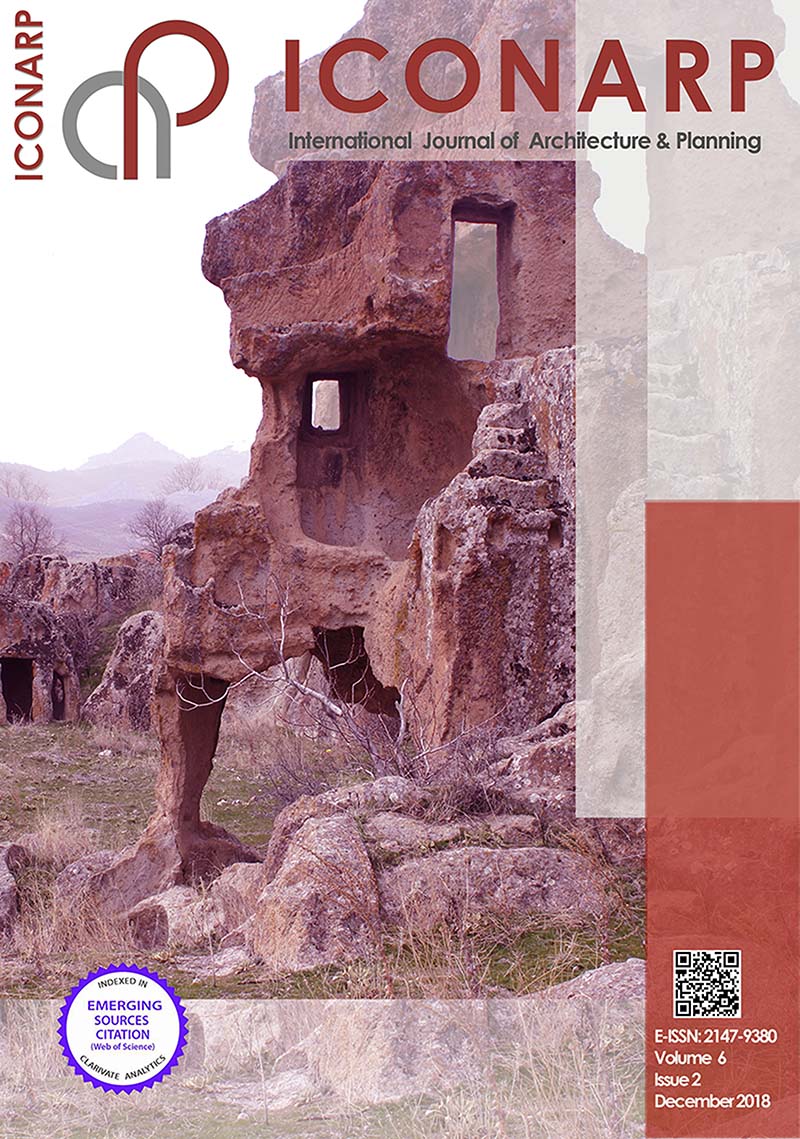
Detailed and accurate measurements can be done by using laser scanning technology compared to conventional methods in documentation of cultural heritage. Accuracy of measured data directly affects the protection of historical buildings and decision-making process. By processing laser scanning data, multipurpose 3d models can be obtained and all work and results can be shared via internet. Moreover, a detailed analysis of the building can be made with this data and it can be transferred to all related engineering and archeological fields. Despite the advantages of this technology, it has not been used widely yet in production of architectural projects. High cost of equipment and data processing software have been seen as main obstacles for widespread using of this technology. As well as, lack of integration of this topic into architectural education and less number of researcher studying in this field restrict the use of laser scanner. In this paper, evaluations were made in order to define the possibilities by using laser scanner technologies in process of restoration projects of which number is getting increased in last decades in Turkey. Positive and negative aspects of technology observed in survey process were given with a case study, a small traditional house in province of Aksaray and some reviews related to potential use of laser scanner technologies were made in Turkey.
Metrics
References
Amans, O. C., Beiping, W., Ziggah, Y. Y., & Daniel, A. O. (2013). The need for 3d laser scanning documentation for select Nigeria cultural heritage sites. European Scientific Journal, ESJ, 9(24).
Andrés, M. A. N., & Pozuelo, F. B. (2009). Evolution of the architectural and heritage representation. Landscape and Urban planning, 91(2), 105-112.
Andrews, D., Bedford, J., Blake, B., Bryan, P., & Cromwell, T. (2013). Measured and drawn: techniques and practice for the metric survey of historic buildings. English heritage.
Arias, P., Herraez, J., Lorenzo, H., & Ordonez, C. (2005). Control of structural problems in cultural heritage monuments using close-range photogrammetry and computer methods. Computers & structures, 83(21-22), 1754-1766.
Armesto-González, J., Riveiro-Rodríguez, B., González-Aguilera, D., & Rivas-Brea, M. T. (2010). Terrestrial laser scanning intensity data applied to damage detection for historical buildings. Journal of Archaeological Science, 37(12), 3037-3047.
Balzani, M., Bughi, C., Ferrari, F., Rossato, L., & Tursi, A. (2012, October). Alberti’s Box: The Cultural Multimedia Project on the Architectures of Leon Battista Alberti. In Euro-Mediterranean Conference (pp. 66-75). Springer, Berlin, Heidelberg.
Boehler, W., Heinz, G., & Marbs, A. (2002). The potential of non-contact close range laser scanners for cultural heritage recording. International archives of photogrammetry remote sensing and spatial information sciences, 34(5/C7), 430-436.
Bruno, F., Bruno, S., De Sensi, G., Luchi, M. L., Mancuso, S., & Muzzupappa, M. (2010). From 3D reconstruction to virtual reality: A complete methodology for digital archaeological exhibition. Journal of Cultural Heritage, 11(1), 42-49.
Callieri, M., Cignoni, P., Dellepiane, M., Ranzuglia, G., & Scopigno, R. (2011). Processing a complex architectural sampling with meshlab: the case of piazza della signoria. Proceedings of 3D-ARCH, 4.
Canciani, M., Falcolini, C., Saccone, M., & Spadafora, G. (2013). From point clouds to architectural models: algorithms for shape reconstruction. ISPRS Archives, 5, W1.
Cappellini, V., & Campi, M. (2011, September). 3d survey of the San Carlo Theatre in Naples. In ISPRS Trento Workshop,(2011) (Vol. 95).
De Matías, J., Berenguer, F., Cortés, J. P., De Sanjosé, J. J., & Atkinson, A. (2013). Laser Scanning for the geometric study of the Alcántara Bridge and Coria Cathedral. ISPRS-International Archives of the Photogrammetry, Remote Sensing and Spatial Information Sciences, 1(1), 51-56.
Docci, M., & Maestri, D. (1994). Manuale di rilevamento architettonico e urbano. Roma: Laterza.
Famukhit, M. L., Yulianto, L., & Maryono, B. E. P. (2013). Interactive application development policy object 3D virtual tour history Pacitan District based multimedia. IJACSA) International Journal of Advanced Computer Science and Applications, 4(3).
Fassi, F., Achille, C., Gaudio, F., & Fregonese, L. (2011). Integrated strategies for the modeling of very large, complex architecture. Proceedings of the International Archives of the Photogrammetry, Remote Sensing and Spatial Information Sciences, Trento, Italy, 2-4.
Fassi, F., Fregonese, L., Ackermann, S., & De Troia, V. (2013). Comparison between laser scanning and automated 3d modelling techniques to reconstruct complex and extensive cultural heritage areas. International Archives of the Photogrammetry, Remote Sensing and Spatial Information Sciences, 5, W1.
Genovese, R. A. (2005). Architectural, archaeological and environmental restoration planning methodology: historic researches and techniques of survey aiming to conservation. In CIPA 2005 XX international symposium, Torino, Italy.
Georgopoulos, A., & Ioannidis, C. (2004, May). Photogrammetric and surveying methods for the geometric recording of archaeological monuments. In FIG Working Week (pp. 22-27).
Haddad, N. A. (2011). From ground surveying to 3D laser scanner: A review of techniques used for spatial documentation of historic sites. Journal of King Saud University-Engineering Sciences, 23(2), 109-118.
http://cipa.icomos.org/fileadmin/template/doc/PRAGUE/147.pdf (accessed, July 2013).
Kersten, T. P., & Lindstaedt, M. (2012, October). Virtual architectural 3d model of the imperial cathedral (kaiserdom) of königslutter, germany through terrestrial laser scanning. In Euro-Mediterranean Conference (pp. 201-210). Springer, Berlin, Heidelberg.
Koska, B., & Kremen, T. (2013). The combination of laser scanning and structure from motion technology for creation of accurate exterior and interior orthophotos of St. Nicholas Baroque church. Int. Arch. Photogramm. Remote Sens. Spat. Inf. Sci, 40, 133-138.
La Mantia, M., & Lanfranchi, F. (2013, February). The reverse modelling realized by digital scans and fotomodellazione: based on post-processing compared several noteworthy episodes contained in the basilical complex of San Lorenzo fuori le Mura in Rome. In ISPRS Trento Workshop,(2011) (Vol. 152).
Leica ScanStation 2 technical sheet, available from: http://hds.leica-ecosystems.com/downloads123/hds/hds/ScanStation/brochures/LeicaScanStation%202_brochure_en.pdf (accessed: July 2013)
Lerones, P. M., Fernández, J. L., Gil, Á. M., Gómez-García-Bermejo, J., & Casanova, E. Z. (2010). A practical approach to making accurate 3D layouts of interesting cultural heritage sites through digital models. Journal of Cultural Heritage, 11(1), 1-9.
Lettelier, R. (1999). Virtual reality... A new tool for sustainable tourism and cultural heritage sites management: Paper presented at CIPA XVII International Symposium Web, Olinda, Brazil.
Loannides, M., Fellner, D., Georgopoulos, A., & Hadjimitsis, D. (2010). Geometric Documentation Of Historical Churches in Cyprus Using Laser Scanner., In Proceedings of EuroMed2010 3rd International Conference Dedicated on Digital Heritage.
Lourenço, P. B., Peña, F., & Amado, M. (2010). A document management system for the conservation of cultural heritage buildings. International Journal of Architectural Heritage, 5(1), 101-121.
Lourenço, P. B., Peña, F., & Amado, M. (2010). A document management system for the conservation of cultural heritage buildings. International Journal of Architectural Heritage, 5(1), 101-121.
Lysandrou, V., & Agapiou, A. (2010). Comparison of documentation techniques for the restoration and rehabilitation of cultural heritage monuments: the example of Pyrgos “Troulli” medieval tower in Cyprus. In 3rd Int. Conf. dedicated on Digital Heritage, Archaeolingua, Limassol, Cyprus (pp. 21-26).
Mamede, C.G., Silva, B.Q., Schuler, C.A.B. (2012). Laser scanner in works of art and historical monuments monitoring, 8th FIG Regional Conference Surveying Towards Sustainable Development, Uruguay
Meyer, É., Grussenmeyer, P., Perrin, J. P., Durand, A., & Drap, P. (2007). A web information system for the management and the dissemination of Cultural Heritage data. Journal of Cultural Heritage, 8(4), 396-411.
Neubauer, W., Doneus, M., Studnicka, N., & Riegl, J. (2005, September). Combined high resolution laser scanning and photogrammetrical documentation of the pyramids at Giza. In CIPA XX International Symposium (pp. 470-475).
Oreni, D., Fassi, F., Brumana, R., Prandi, F., & Tuncer, H. (2006). Laser Canning supports architectural mappings and historical urban view analysis. In XI International CIPA Symposium.
Patias, P. (2009). Cultural Heritage Documentation. International Summer School ‘Digital recording and 3D Modeling’, Aghios Nikolaos, Crete, Greece, 24–29 April.
Pavlidis, G., Koutsoudis, A., Arnaoutoglou, F., Tsioukas, V., & Chamzas, C. (2007). Methods for 3D digitization of cultural heritage. Journal of cultural heritage, 8(1), 93-98.
Prabawati, T. A., & Triyuliana, A. H. (2006). Multimedia: Making It Work edisi 6. Yogyakarta: Penerbit ANDI.
R. Sitnik, P. Bolewicki, J. Rutkiewicz, J. Michonski, M. Karaszewski, J. Lenar, K. Mularczyk, W. Zaluski. (2010). Project “revitalization and digitization of the seventeenth century palace complex and garden in Wilanow – phase III” task “3d digitalization of selected exhibits collection”EuroMed2010 International Conference.
Reffat, R. M., & Nofal, E. M. (2013). Effective communication with cultural heritage using virtual technologies. International Archives of the Photogrammetry, Remote Sensing and Spatial Information Sciences, 5, W2.
Remondino, F., Del Pizzo, S., Kersten, T. P., & Troisi, S. (2012, October). Low-cost and open-source solutions for automated image orientation–A critical overview. In Euro-Mediterranean Conference (pp. 40-54). Springer, Berlin, Heidelberg.
Rizzi, A., Baratti, G., Jimenez, B., Girardi, S., & Remondino, F. (2011). 3D recording for 2D delivering–The employment of 3D models for studies and analyses. Int. Archives of Photogrammetry, Remote Sensing and Spatial Information Sciences, 38, 5.
Rüther, H., Held, C., Bhurtha, R., Schröder, R., & Wessels, S. (2011). Challenges in heritage documentation with terrestrial laser scanning. In Proceedings of the 1st AfricaGEO Conference, Capetown, South Africa (Vol. 30).
Rüther, H., Held, C., Bhurtha, R., Schroeder, R., & Wessels, S. (2012). From point cloud to textured model, the zamani laser scanning pipeline in heritage documentation. South African Journal of Geomatics, 1(1), 44-59.
Salonia, P., Bellucci, V., Scolastico, S., Marcolongo, M., & Leti Messina, T. (2007, October). 3D survey technologies for reconstruction, analysis and diagnosis in the conservation process of cultural heritage. In Proceedings of CIPA.
Salonia, P., Scolastico, S., Pozzi, A., Marcolongo, A., & Messina, T. L. (2009). Multi-scale cultural heritage survey: Quick digital photogrammetric systems. Journal of Cultural Heritage, 10, e59-e64.
Santana Quintero, M., Blake, B., Eppich, R., & Ouimet, C. (2008, January). Heritage documentation for conservation: partnership in learning. In The Spirit of Place. ICOMOS.
Sofocleous, E., Ioannides, M., & Ioannidis, C. (2006). The geometric documentation of the asinou church in cyprus. In Proceedings of the 7th International Symposium on Virtual Reality, Archaeology and Cultural Heritage, Lefkosia Cyprus.
Stathopoulou, E. K., Lerma, J. L., & Georgopoulos, A. (2010). Geometric documentation of the almoina door of the cathedral of Valencia. In Proceedings of EuroMed2010 3rd International Conference Dedicated on Digital Heritage.
Tucci, G., Cini, D., & Nobile, A. (2012). A Defined Process to Digitally Reproduce in 3 D a Wide Set of Archaeological Artifacts for Virtual Investigation and Display. Journal of earth science and engineering, 2(2), 118-131.
U.N.E.S.C.O. (1972). Photogrammetry applied to the survey of HistoricMonuments, of Sites and to Archaeology, UNESCO editions.
Vacca, G., Deidda, M., Dessi, A., & Marras, M. (2012). Laser scanner survey to cultural heritage conservation and restoration. International Archives of the Photogrammetry, Remote Sensing and Spatial Information Sciences, 39(B5), 589-594.
Valanis, A., Fournaros, S., & Georgopoulos, A. (2010). Photogrammetric texture mapping of complex objects. In Proceedings of Eur-oMed2010 3rd International Conference dedicated on Digital Heritage.
Van Genechten, B. (2008). Theory and practice on Terrestrial Laser Scanning: Training material based on practical applications.
Versaci, A., & Cardaci, A. (2011). Web-sharing for a cultural heritage computer database of Central Sicilian monuments. CIPA, ISPRS syposium, Prague, available from:
Yilmaz, H. M., Yakar, M., Gulec, S. A., & Dulgerler, O. N. (2007). Importance of digital close-range photogrammetry in documentation of cultural heritage. Journal of Cultural Heritage, 8(4), 428-433.
Downloads
Published
How to Cite
Issue
Section
License
COPYRIGHT POLICY
1. The International Journal of Architecture and Planning (ICONARP) open access articles are licensed under a Creative Commons Attribution-NonCommercial-NoDeriatives 4.0 International (CC BY-NC-ND 4.0). This license lets the author to share (copy and redistribute) his/her article in any medium or format.
2. ICONARP cannot revoke these freedoms as long as you follow the license terms. Under the following terms:
The author must give appropriate credit, provide a link to ICONARP, and indicate if changes were made on the article. The author may do so in any reasonable manner, but not in any way that suggests the ICONARP endorses the author or his/her use.
The author may not use the article for commercial purposes.
If the author remix, transform, or build upon the article, s/he may not distribute the modified material.
The author may share print or electronic copies of the Article with colleagues.
The author may use the Article within his/her employer’s institution or company for educational or research purposes, including use in course packs.
3. The author authorizes the International Journal of Architecture and Planning (ICONARP) to exclusively publish online his/her Article, and to post his/her biography at the end of the article, and to use the articles.
4. The author agrees to the International Journal of Architecture and Planning (ICONARP) using any images from the Article on the cover of the Journal, and in any marketing material.
5. As the author, copyright in the Article remains in his/her name.
6. All papers should be submitted electronically. All submitted manuscripts must be original work that is not under submission at another journal or under consideration for publication in another form, such as a monograph or chapter of a book. Authors of submitted papers are obligated not to submit their paper for publication elsewhere until an editorial decision is rendered on their submission. Further, authors of accepted papers are prohibited from publishing the results in other publications that appear before the paper is published in the Journal.


 ICONARP International Journal of Architecture and Planning is an OAJ supported by